Interpretación y cartografía de paleolíneas de costa lacustres mediante fotografías aéreas de alta resolución y datos LiDAR en la laguna de Gallocanta (NE España)
DOI:
https://doi.org/10.17735/cyg.v32i1-2.62066Palabras clave:
MDE, cartografía, líneas de costa, terrazas lacustres, litoral, fotointerpretaciónResumen
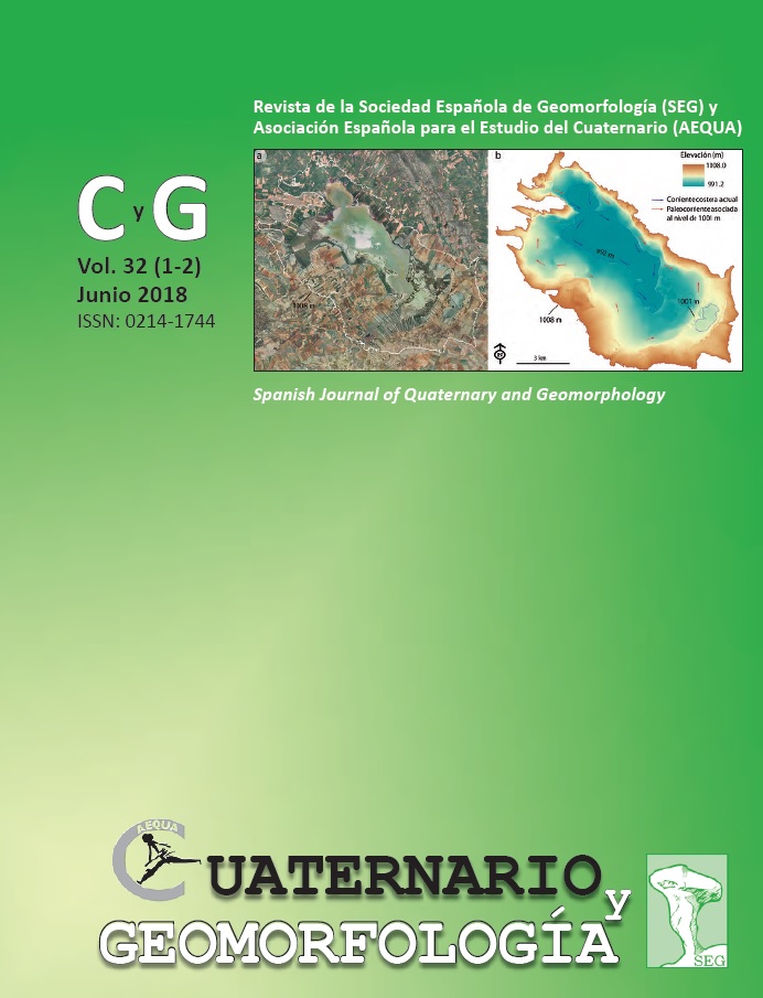
La laguna de Gallocanta, de 14 km2 de extensión, se localiza entre las provincias de Zaragoza y Teruel. Sufre frecuentes fluctuaciones del nivel de agua, que oscilan entre la desecación total y un máximo de casi 3 m de profundidad. Está expuesta a vientos fuertes y persistentes del NO, que originan oleaje, corrientes y transporte de sedimentos a lo largo de litorales donde son habituales las playas, flechas, cordones y otras formas costeras. La identificación de antiguos cordones litorales del Pleistoceno Superior en canteras situadas en la zona perilagunar, sugiere una extensión mucho mayor del ámbito lacustre en pocas pasadas, alcanzando al menos 45 km2 de lámina de agua, ubicada a más de 15 m de altura por encima del fondo actual. Las llanuras perilacustres existentes entre dichos cordones y la laguna actual albergan registros morfosedimentarios de paleolíneas de costa de tiempos holocenos e históricos. Dada la gran dificultad de reconocer estas morfologías relictas mediante métodos tradicionales, se emplearon dos fuentes de información: fotografías aéreas de alta resolución (1:15.000) y un modelo digital del terreno generado con datos LiDAR con una precisión de 0,2 m. Se analizó la topografía de forma continua extrayendo las curvas de nivel, para obtener una interpretación topográfica de alta precisión. Posteriormente, se integraron los resultados, operando en entorno SIG, y se realizó una inspección de campo. Como resultado se ha obtenido una serie de secuencias de formas litorales relictas escalonadas que rodean completamente la laguna actual con gran continuidad lateral. Se han identificado unos 10 niveles relictos, algunos de ellos con espectaculares formas litorales bien conservadas como flechas con ganchos recurvados, contraflechas, bahías cerradas por islas barrera, sistemas de barras paralelas, paleodeltas, etc. Estas formas permiten una reconstrucción inicial de la dinámica litoral dominante en tiempos pasados.Descargas
Citas
Abu Ghazleh, S.; Kempe, S. (2009). Geomorphology of Lake Lisan terraces along the eastern coast of the Dead Sea, Jordan. Geomorphology, 108, 246-263. https://doi.org/10.1016/j.geomorph.2009.02.015
Aranbarri, J.; González-Sampériz, P.; Valero-Garcés, B.; Moreno, A.; Gil-Romera, G.; Sevilla-Callejo, M.; García-Prieto, E.; Di Rita, F.; Mata, M.P.; Morellón, M.; Magri, D.; Rodríguez-Lázaro, J.; Carrión, J. (2014). Rapid climatic changes and resilient vegetation during the Lateglacial and Holocene in a continental region of south-western Europe. Global and Planetary Change, 114, 50–65. https://doi.org/10.1016/j.gloplacha.2014.01.003
Bañuls-Cardona, S.; López-García, J.M.; Blain, H.A.; Lozano-Fernández, I.; Cuenca-Bescós, G. (2014). The end of the Last Glacial Maximum in the Iberian Peninsula characterized by the small-mammal assemblages. Journal of Iberian Geology, 40, 19-27.
http://dx.doi.org/10.5209/rev_JIGE.2014.v40.n1.44085
Barber, C.P.; Shortridge, A. (2005). Lidar Elevation Data for Surface Hydrologic Modeling: Resolution and Representation Issues. Cartography and Geographic Information Science, 32 (4), 401-410. https://doi.org/10.1559/152304005775194692
Benavente, J.; Del Río, L.; Plomaritis, T.A.; Menapace, W. (2013). Impact of coastal storms in a sandy barrier (Sancti Petri, Spain). Journal of Coastal Research, SI 65, 666‐671. https://doi.org/10.2112/SI65-113.1
Bishop, M.P.; James, L.A.; Shroder, J.F.; Walsh, S.J. (2012). Geospatial technologies and digital geomorphological mapping: Concepts, issues and research. Geomorphology, 137, 5-26. https://doi.org/10.1016/j.geomorph.2011.06.027
Bowman, D. (1971). Geomorphology of the shore terraces of the Late Pleistocene Lisan Lake Israel. Palaeogeography, Palaeoclimatology, Palaeoecology, 9, 183-209. https://doi.org/10.1016/0031-0182(71)90031-9
Burbank, D.K.; Anderson, R.S. (2012). Tectonic Geomorphology. Wiley-Blackwell, 288 pp.
Burjachs, F.; Rodó, X.; Comín, F.A. (1996). Gallocanta: ejemplo de secuencia palinológica en una laguna efímera. En: Estudios Palinológicos (B. Ruiz Zapata, ed.). Universidad de Alcalá, Alcalá de Henares, 25-29.
Burrough, S.L.; Thomas, D.S.G.; Shaw, P.A.; Bailey, R.M. (2007). Multiphase Quaternary highstands at Lake Ngami, Kalahari, northern Botswana. Palaeogeography, Palaeoclimatology, Palaeoecology, 253, 280-299. https://doi.org/10.1016/j.palaeo.2007.06.010
Burrough, S.L.; Thomas, D.S.G. (2009). Geomorphological contributions to palaeolimnology on the African continent. Geomorphology, 103, 285-298. https://doi.org/10.1016/j.geomorph.2008.07.015
Castañeda, C.; Gracia, F.J.; Meyer, A.; Romeo, R. (2013). Coastal landforms and environments in the central sector of Gallocanta saline lake (Iberian Range, Spain). Journal of Maps, 9 (4), p. 584-589. https://doi.org/10.1080/17445647.2013.829413
Castañeda, C.; Gracia, F.J.; Luna, E.; Rodríguez, R. (2015). Edaphic and geomorphic evidences of water level fluctuations in Gallocanta Lake, NE Spain. Geoderma, 239-240, 265-279. https://doi.org/10.1016/j.geoderma.2014.11.005
Chiverrell, R.C.; Thomas, G.S.P.; Foster, G.C. (2008). Sediment–landform assemblages and digital elevation data: Testing an improved methodology for the assessment of sand and gravel aggregate resources in north-western Britain. Engineering Geology, 99, 40-50. https://doi.org/10.1016/j.enggeo.2008.02.005
Comín, F.A.; Rodó, X.; Comín, P. (1992). Lake Gallocanta (Aragón, NE Spain), a paradigm of fluctuations at different scales of time. Limnetica, 8, 79-86.
Currey, D.R. (1994). Hemiarid lake basins: geomorphic patterns. En: Geomorphology of Desert Environments (A.D. Abrahams; A.J. Parsons, eds.). Chapman and Hall, London, 422-444. https://doi.org/10.1007/978-94-015-8254-4_16
Damnati, B.; Etebaai, I.; Benjilani, H.; El Khoudri, K.; Reddad, H.; Taieb, M. (2016). Sedimentology and geochemistry of lacustrine terraces of three Middle Atlas lakes: Paleohydrological changes for the last 2300 cal BP in Morocco (western Mediterranean region). Quaternary International, 404, 163-173. https://doi.org/10.1016/j.quaint.2015.10.038
De Gelder, G.; Fernández-Blanco, D.; Lacassin, R.; Armijo, R.; Delorme, A.; Jara-Muñoz, J.; Melnick, D. (2015). Corinth terraces re-visited: Improved paleoshoreline determination using Pleiades-DEMs. Geotectonic Research, 97, 12-14. https://doi.org/10.1127/1864-5658/2015-06
Fernández-Núñez, M.; Burningham, H.; Ojeda Zújar, J. (2017). Improving accuracy of LiDAR-derived digital terrain models for saltmarsh management. Journal of Coastal Conservation, 21, 209-222. https://doi.org/10.1007/s11852-016-0492-2
Ghienne, J.F.; Schuster, M.; Bernard, A.; Duringer, P.; Brunet, M. (2002). The Holocene giant Lake Chad revealed by digital elevation models. Quaternary International, 87, 81-85. https://doi.org/10.1016/S1040-6182(01)00063-5
Gómez, C.; Hayakawa, Y.; Obanawa, H. (2015). A study of Japanese landscapes using structure form motion derived DSMs and DEMs based on historical aerial photographs: New opportunities for vegetation monitoring and diachronic geomorphology. Geomorphology, 242, 11-20. https://doi.org/10.1016/j.geomorph.2015.02.021
Gracia, F.J. (1993). Fisiografía de la laguna de Gallocanta y su cuenca. Xiloca, 11, 177-204.
Gracia, F.J. (1995). Shoreline forms and deposits in Gallocanta Lake (NE Spain). Geomorphology, 11, 323-335. https://doi.org/10.1016/0169-555X(94)00080-B
Gracia, F.J. (2014). Gallocanta Saline Lake, Iberian Chain. En: Landscapes and Landforms of Spain (F. Gutiérrez; M. Gutiérrez, eds). Springer Science + Business Media, Dordrecht, 137-144. https://doi.org/10.1007/978-94-017-8628-7_11
Gracia, F.J.; Gutiérrez, F.; Gutiérrez, M. (1999). Evolución geomorfológica del polje de Gallocanta (Cordillera Ibérica). Revista de la Sociedad Geológica de España, 12 (3-4), 351 - 368.
Gracia, F.J.; Gutiérrez, F.; Gutiérrez, M. (2002). Origin and evolution of the Gallocanta polje (Iberian Range, NE Spain). Zeitschrift für Geomorphologie, 46, 245-262.
Gracia, F.J.; Santos, J.A. (1992). Caracterización sedimentológica y modelo deposicional costero de una terraza lacustre pleistocena en la Laguna de Gallocanta (Provincia de Zaragoza). En: Simposium sobre Sedimentación Lacustre (L. Cabrera; P. Anadón, eds.). III Congr. Geol. España, S.G.E., Salamanca, vol. I de Simps., 98 - 107.
Goudie, A.S. (2013). Arid and Semiarid Environments. Cambridge University Press, Cambridge, England, 454 pp.
Gutiérrez Elorza, M. (1998). Geomorfología y cambio climático en zonas áridas. Academia de Ciencias Exactas, Físicas, Químicas y Naturales de Zaragoza, 97 pp.
Hare, J.L.; Ferguson, J.F.; Aiken, C.L.V.; Oldow, J.S. (2001). Quantitative characterization and elevation estimation of Lake Lahontan shoreline terraces from high-resolution digital elevation models. Journal of Geophysical Research, 106, 26761-26774. https://doi.org/10.1029/2001JB000344
Hernández, A.; Olivé, A.; Moissenet, E.; Pardo, G.; Villena, J.; Portero, J.M.; Gutiérrez, M. (1983). Memoria y Mapa Geológico de España, 1:50,000, Hoja nº 491, Calamocha. Instituto Geológico y Minero de España, Madrid, 73 pp.
Hudson, A.M.; Quade, J.; Huth, T.E.; Lei, G.; Cheng, H.; Edwards, L.R.; Olsen, J.W.; Zhang, H. (2015). Lake level reconstruction for 12.8-2.3 ka of the Ngangla Ring Tso closed-basin lake system, southwest Tibetan Plateau. Quaternary Research, 83, 66-79. https://doi.org/10.1016/j.yqres.2014.07.012
Jara-Muñoz, J.; Melnick, D.; Strecker, M. (2015). TerraceM: A Matlab® tool to analyze marine terraces from high-resolution topography. Geophysical Research Abstracts, 17, EGU2015-11480-3.
Ji, Z.G.; Jin, K.R. (2014). Impacts of wind waves on sediment transport in a large, shallow lake. Lakes and Reservoirs: Research and Management, 19, 118-129. https://doi.org/10.1111/lre.12057
Jones, K.L.; Poole, G.C.; O'Daniel, S.J.; Mertes, L.A.K.; Stanford, J.A. (2008). Surface hydrology of low-relief landscapes: assessing surface water flow impedance using LIDAR-derived digital elevation models. Remote Sensing and the Environment, 112 (11), 4148-4158. https://doi.org/10.1016/j.rse.2008.01.024
Krumbein, W.C., Sloss, L. (1955). Stratigraphy and sedimentation. Freeman & Co., San Francisco, 497 pp.
Luna, E.; Castañeda, C.; Gracia, F.J. y Rodríguez-Ochoa, R. (2016). Late Quaternary pedogenesis of lacustrine terraces in Gallocanta Lake, NE Spain. Catena, 147, 372-385. https://doi.org/10.1016/j.catena.2016.07.046
Luzón, A.; Pérez, A.; Mayayo, M.J.; Soria, A.R.; Goñi, M.F.S.; Roc, A.C. (2007). Holocene environmental changes in the Gallocanta lacustrine basin, Iberian Range, NE Spain. The Holocene, 17, 649-663. https://doi.org/10.1177/0959683607078994
Martínez-Cob, A.; Zapata, N.; Sánchez, I. (2010). Viento y riego. La variabilidad del viento en Aragón y su influencia en el riego por aspersión. Institución Fernando El Católico, Zaragoza, 200 pp.
Mermut, A.R.; Acton, D.F. (1984). The age of some Holocene soils on the Ear Lake terraces in Saskatchewan. Canadian Journal of Soil Sciences, 64, 163-172. https://doi.org/10.4141/cjss84-018
Newell, W.L.; Clark, I. (2008). Geomorphic Map of Worcester County, Maryland, Interpreted from a LIDAR-Based, Digital Elevation Model. U.S. Geological Survey Open-File Report 2008-1005, 34 pp.
Nordstrom, K.F.; Jackson, N.L. (2012). Physical processes and landforms on beaches in short fetch environments in estuaries, small lakes and reservoirs: a review. Earth Science Reviews, 111,232-247. https://doi.org/10.1016/j.earscirev.2011.12.004
Ocakoglu, F.; Kir, O.; Yilmaz, I.Ö.; Açikalin, S.; Erayik, C.; Tunoglu, C.; Leroy, S.A.G. (2013). Early to Mid-Holocene lake level and temperature records from the terraces of Lake Sünnet in NW Turkey. Palaeogeography, Palaeoclimatology, Palaeoecology, 369, 175-184. https://doi.org/10.1016/j.palaeo.2012.10.017
Olmo, P. Del; Portero, J.M.; Gutiérrez, M. (1983a). Memoria y Mapa Geológico de España, E. 1:50,000, Hoja nº 464, Used. Instituto Geológico y Minero de España, Madrid, 74 pp.
Olmo, P. Del; Portero, J.M.; Villena, J.; Pardo, G.; Gutiérrez, M. (1983b). Memoria y Mapa Geológico de España, E. 1:50,000, Hoja nº 490, Odón. Instituto Geológico y Minero de España, Madrid, 76 pp.
Otto, J.C.; Smith, M.J. (2013). Section 2.6. Geomorphological mapping. En: Geomorphological Techniques (S.J. Cook; L.E. Clarke; J.M. Nield, eds.). Online Edition. British Society for Geomorphology, London.
Orme, A.J.; Orme, A.R. (1991). Relict barrier beaches as paleoenvironmental indicators in the California Desert. Physical Geography, 12, 334-346.
Otvos, E.G. (2000) Beach ridges - definitions and significance. Geomorphology 32: 83-108. https://doi.org/10.1016/S0169-555X(99)00075-6
Raji, O.; Del Río, L.; Gracia, F.J.; Benavente, J. (2011). The use of LIDAR data for mapping coastal flooding hazard related to storms in Cádiz Bay (SW Spain). Journal of Coastal Research, S.I. 64, 1881-1885.
Rodó, X. (1997). Escales temporals de variabilitat ecològica en un ecosistema aquàtic fluctuant: la llacuna de Gallocanta (Aragó). Tesis doctoral inédita, Universidad de Barcelona, 408 pp.
Rosen, P.S. (1982). Cuspate spits. En: Beaches and Coastal Geology (M.L. Schwarthz, M.L., ed.). Encyclopedia of Earth Science, Springer, 349-351. https://doi.org/10.1007/0-387-30843-1_143
Saksena, S.; Merwade, V. (2015). Incorporating the effect of DEM resolution and accuracy for improved flood inundation mapping. Journal of Hydrology, 530, 180-194. https://doi.org/10.1016/j.jhydrol.2015.09.069
Sander, L., Hede, M.U.; Fruergaard, M.; Nielsen, L.; Clemmensen, L.B.; Kroon, A.; Johannessen, P.N.; Nielsen, L.H.; Pejrup, M. (2016). Coastal lagoons and beach ridges as complementary sedimentary archives for the reconstruction of Holocene relative sea-level changes. Terra Nova, 28, 43-49. https://doi.org/10.1111/ter.12187
Schumann, G.; Matgen, P.; Cutler, M.E.J.; Black, A.; Hoffmann, L.; Pfister, L. (2008). Comparison of remotely sensed water stages from LiDAR, topographic contours and SRTM. ISPRS Journal of Photogrammetry, 63 (3), 283-296. https://doi.org/10.1016/j.isprsjprs.2007.09.004
Schuster, M.; Roquin, C.; Duringer, P.; Brunet, M.; Caugy, M.; Fontugne, M.; Mackaye, H.; Vignaud, P.; Ghienne, J.F. (2005). Holocene Lake Mega-Chad palaeoshorelines from space. Quaternary Science Reviews, 24, 1821-1827. https://doi.org/10.1016/j.quascirev.2005.02.001
Schütt, B. (1998). Reconstruction of Holocene paleoenvironments in the endorheic basin of Laguna de Gallocanta, Central Spain by investigation of mineralogical and geochemical characters from lacustrine sediments. Journal of Paleolimnology, 20, 217-234. https://doi.org/10.1023/A:1007924000636
Skorko, K.; Jewell, P.W.; Nicoll, K. (2012). Fluvial response to an historic lowstand of the Great Salt Lake, Utah. Earth Surface Processes and Landforms, 37, 143-156. https://doi.org/10.1002/esp.2226
Smith, M.J. (2011). Digital Mapping: Visualisation, Interpretation and Quantification of Landforms. En: Geomorphological Mapping: methods and applications (M.J. Smith; P. Paron; J.S. Griffiths, eds). Developments in Earth Surface Processes, 15. Elsevier, London, 225-249. https://doi.org/10.1016/B978-0-444-53446-0.00008-2
Tamura, T. (2012). Beach ridges and prograded beach deposits as palaeoenvironmental records. Earth Science Reviews, 114, 279-297. https://doi.org/10.1016/j.earscirev.2012.06.004
Tarolli, P.; Dalla Fontana, G. (2009). Hillslope-to-valley transition morphology: New opportunities from high resolution DTMs. Geomorphology, 113, 47-56. https://doi.org/10.1016/j.geomorph.2009.02.006
Tarolli, P.; Sofia, G.; Dalla Fontana, G. (2012). Geomorphic features extraction from high-resolution topography: landslide crowns and bank erosion. Natural Hazards, 61, 65-83. https://doi.org/10.1007/s11069-010-9695-2
Thompson, T.A. (1992). Beach-ridge development and lake-level variation in southern Lake Michigan. Sedimentary Geology, 80, 305-318. https://doi.org/10.1016/0037-0738(92)90048-V
Thompson, T.A.; Baedke, S.J. (1995). Beach-ridge development in Lake Michigan: shoreline behavior in response to quasi-periodic lake-level events. Marine Geology, 129, 163-174. https://doi.org/10.1016/0025-3227(95)00110-7
Timms, B.V. (1992). Lake Geomorphology. Gleneagles Publishing, Adelaide, 180 pp.
Turmel, D.; Locat, J.; Parker, G. (2015). Morphological evolution of a well-constrained, subaerial-subaqueous source to sink system: Wabush Lake. Sedimentology, 62, 1636-1664. https://doi.org/10.1111/sed.12197
Wang, J.; Jiang, Z.; Xian, B.; Chen, J.; Wang, X.; Xu, W.; Liu, H. (2017). A method to define the palaeowind strength from lacustrine parameters. Sedimentology. Doi: 10.1111/sed.12388. https://doi.org/10.1111/sed.12388
White, S.A.; Wang, Y. (2003). Utilizing DEMs derived from LIDAR data to analyze morphologic change in the North Carolina coastline. Remote Sensing and the Environment, 85 (1), 39-47. https://doi.org/10.1016/S0034-4257(02)00185-2
Woolard, J.W.; Colby, J.D. (2002). Spatial characterization, resolution, and volumetric change of coastal dunes using airborne LIDAR: Cape Hatteras, North Carolina. Geomorphology, 48, 269-287. https://doi.org/10.1016/S0169-555X(02)00185-X
Zhang, W.; Harff, J.; Schneider, R.; Wu, C. (2010). Development of a modeling methodology for simulation of long-term morphological evolution of the southern Baltic coast. Ocean Dynamics, 60, 1085-1114. https://doi.org/10.1007/s10236-010-0311-5
Zenkovich, V.P. (1967). Processes of Coastal Development. Oliver and Boyd, Edinburgh, 378 pp.